tv 9 News Now at 5pm CBS October 30, 2012 5:00pm-6:00pm EDT
5:00 pm
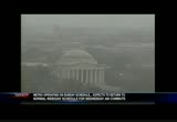
sandy but first meteorologist topper shutt in the weather center. >> i could have been in many ways, we were lucky. of course some folks would argue with that. but i think across the board, we were pretty lucky. let's start with the radar picture and still under the influence in you will of the circulation of quote sandy unquote. we still have showers around the metro area and it's kind of weird with the southwest wind we have temperatures in the upper 30s and low 40s. so it feels like march outside and notice the showers go all the way back to -- chicago. this is still a pretty big storm. we'll zo in a little bit. some showers around the beltway and some snow you mp the divide into garrett county. this is pretty good snow going on too. pictures coming up in about a 15 minutes or so -- 15 minutes or so. mixture of snow and rain in cumberland and a cold rain winchester northward. the historical perspective of
5:01 pm
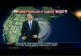
sandy. largest hurricane by diameter. 945 miles in diameter. igor was 920 and olga back in 1921 with 965 miles. for better perspective we'll move the hurricane on land okay and talk about exactly the -- breadth that it would have affected had it been parked on the eastern u.s.. there's how big it was. it would have affected des moines to houston to key west all the way up to maine. it will slowly pull away and we'll talk about that and also talk about when the rivers will crest in our area. all right, topper, superstorm sandy brought down trees, just about everywhere and we were there with one stunned family after a massive tree crashed through their roof. our todd walker is live from northwest d.c. where the family took him inside to tour all the damage. oh no. todd? >> reporter: it is quite a mess and you know what? they're still cleaning pretty much the mess, not even -- up
5:02 pm
from the mess. not even halfway done wit. when that tree went down it went into power lines and snapped that power pole in half. if you look behind the power pole, you can see that tree is still there. all four members of the family was inside. it was a scary situation but it has them counting their blessings. >> huge tree and it was a beautiful tree. >> reporter: this is not how jay and her husband dan planned their remodel going. >> i was in the bathroom and i walked in here and that was sticking down. >> reporter: they'd always wanted a skylight but in the middle of a hurricane is not the best time. but sandy had other plans. >> . if we hadn't done the aadditional this would have hit him. >> reporter: getting ready to hunker down for the night, jay said the tree was unmistakable. >> the smash just came. it was so sudden and it was so -- i've been through an earthquake and the severity of the shaking was absolutely frightening. >> reporter: luckily with four people in the house, everyone was in just the right place as
5:03 pm
the unplanned ceiling demolition started. >> i kept discovering more holes. this one was gone. there's a hole in our bedroom. there's other holes in the roof. so basically our house has been penetrated pretty intensivety already. >> reporter: that means they're out of the historic house for the foreseeable future. >> it takes a while for it to sink in. >> reporter: making it out of the house without a scratch. >> everyone is okay, this was so massive. >> reporter: so big and it could have been a lot worse because the power lines the tree went down on. they were still alive and it was spark everywhere. they were worried the house could have caught on fire. back to you. >> boy, they are very very lucky tonight. anita? meanwhile in ocean city, maryland it took until 2:30 this afternoon to get things the cleaned up enough to allow evacuees back into the downtown area. sandy provided a lot of drama and let the significant -- left a significant amount of damage. our scott broom is live from
5:04 pm
his mobile newsroom at the inlet with more on ocean city's recovery. scott? >> reporter: on the dashboard camera in the inlet still covered with sand, you know, ocean city from 17th street south including here at the inlet was evacuated as sandy pressed close and as i got out and about today with this mobile newsroom, you could see why that evacuation was mandatory. >> oh, it was just here on sunday. we were out here on sunday taking pictures. >> reporter: everyone here wants a picture of this. >> you know, it's been there ever since i was a kid. >> reporter: the 100 feet of empty space where ocean city's fishing pier once stood. >> it's kind of devastating. >> reporter: but it's ocean city's back streets, those on the bayside of this barrier island that suffered the most from an eight foot storm surge and 74-mile-per-hour winds. a pontoon boat was a block inland near 352nd street. >> could have been worse though. >> reporter: on the boardwalk business owners assessed damage
quote
5:05 pm
from flooding that
5:06 pm
the amount
5:07 pm
further inland. firefighters in frederick, derrick? >> thanks anita. the firefighters in frederick rescued two men from a flooding river in frederick and that flood threat is not done yet. ryan dean is live from the river with the latest. what happened ryan? >> reporter: well, that's right. we've been here about two hours and a lot of folks who are just coming up and seeing this river are saying wow let's show you what it looks like currently the monocacy river here in frederick county. the level's about 21 feet right now. i've been here about two hours but sarah shookman has been here all day long and she has more on this river. >> maryland 355 over the monocacy river is always a scenic spot but superstorm sandy has turned the river near the national historic battlefield into an attraction. >> it's incredible that something like a storm like that can dump this much water off that -- that fast. is amazing. >> it's just rushing through.
5:08 pm
and coming dangerously close to the bottom of the bridge. >> reporter: the monocacy river continued to swell through the afternoon cresting at 21 feet. >> it's really rare for us totable see water -- to actually see water. >> reporter: into chris' backyard, they watched as trees disappeared from view trying to measure the flood. >> this is my very first hurricane and i don't know how the river is going to react. >> reporter: or how people are react to the will be will react to the -- will react to the extreme conditions. too much for two men attempting to use that raft to float down these flooded fields. frederick county fire and walkersville volunteer crews used a tower truck and a boat to rescue them. barbara hubbard says even the dogs were ready to venture out to see the damage. >> they got cabin fever too. [ laughter ] >> reporter: in frederick counselty, sarah shookman, 9news now. >> and so we -- the crest is at 2150 feet and you know the --
5:09 pm
21 feet and you know the flood stage is at 15 feet. the historical crest was in 1972 and that was at 35 feet. that's the very latest in frederick county, i'm ryan dean back to you. >> thank you. the rain we got from sandy, it was a blizzard elsewhere. coming up a look at what the superstorm is doing in the mountains of maryland and west virginia. >> yep, that's cool stuff. we'll also come back and talk about some of the rivers that are going to flood and we give you the times that they might crest. >> in the aftermath of hurricane sandy the subway lines are not running and the power remains out and now there are reports of looting. i'm vinita nair with the latest coming up. >> and we want to remind you to news is committed to keeping your family safe in the aftermath of-type storm sandy. to -- superstorm sandy. to get introductions on how to download the mobile app.
5:10 pm
5:13 pm
you think we had it tough? new york city is still struggling to get back on its feet after sandy just ripped through the big apple last night. and some of the images. >> vinita nair has the latest from new york. >> reporter: the latest news to report is disappointing news. there are reports that there was looting both during and after this storm. nine people in queens, they have been arrested on charges of looting. a clothing store, a radio shack as well as a gas station. garbage bins and tree branches were left behind. sandy's powerful winds and
5:14 pm
storm surge slammed the city and rattled its residents. >> the entire residence here has been flooded out. our entire basement right now we have no electricity. >> reporter: the city remains paralyzed and many businesses are closed. power is still out for tens of thousands. and the city's subway system is shut down. the mayor says it could be days before subways are up and running again. >> make no mistake about this. this was a devastating storm. maybe the worst that we have ever experienced. >> i don't think that we expected the damage that we're seeing as we're walking around the neighborhood. >> reporter: storm surge flooded this entire area of lower manhattan last night and it crashed over the seawalls at a record height of almost 14 feet. the water poured into the brooklyn battery tunnel and new yorkers say they have never seen anything like it. >> this is quite a phenomenon to have a weather front like this come through here. >> reporter: fierce winds ripped the facade from a four story manhattan apartment building. in breezy point, queens, a massive fire now extinguished dried at least 8 -- destroyed
5:15 pm
at least 80 homes. on long island home video caught this amazing site. the mayor is saying at least ten people died in the storm and we're hearing more about those folks. we know one was at least a first responder someone trying to help someone else. another two were people who were trapped in their home and a fourth we know was someone that stepped in a puddle that was electrically charged. anita back to you. >> wow. amazing stories. that's a very sad one. transit officials say at least ten subway tunnels in new york city still submerged underwater. and the national guard had to be called in to help people escape flood waters in northern new jersey. a tidal surge left three towns there underwater and hundreds of people were trapped in the low lying town in new jersey after a creek overflowed. now this is video from long beach island where the storm tossed around hundreds of boats. search and rescue teams also fanned out across atlantic city. and governor chris christie had some harsh words for the city's
5:16 pm
mayor for failing to order evacuations. >> many people said to us no, the mayor said we can stay here. i mean those are the kind of mixed messages that at their worst moment can cost lives. >> we had waves as high as the light poles down on the boardwalk. >> experts put a price tag on $10 billion to $20 billion for sandy and that makes it one of the most expensive in history. sandy helped trigger a huge snowstorm further inland. at least two feet of snow fell in west virginia and tennessee and north carolina. storm caused several accidents and left many stranded on roads and thousands without power. a winter storm warning remains in effect for those areas until tonight. so we know it could have been a lot worse around here topper? >> last year we had a snowstorm on this date pretty much. not much downtown but 10-inches in the northern burrens. >> that's nothing like what we saw yesterday. >> this was incredible and you know i think in some ways we
5:17 pm
were lucky. i mean we had 60, 70-mile-per- hour winds but all in all? some power outages but nothing like again further up in new york. >> pepco says the power will be back on for them tomorrow night? >> that's pretty good. >> pretty good. >> so we kind of you know lost the story in terms of winds and now the possibility of flooding. a lot of rain fell in the -- in north and west of town. all got to drain down in the potomac. let's start with the possibility of flooding and for the most part we have good news. the other part is it's going to change a little bit. we'll start with a live look outside -- although i don't -- oh. no. no, no we don't want that. let's keep the live look outside shall we? yeah, we were looking at -- a little bit of cloud activity. kind odd like -- it's actually kind of like well, march? it feels like march anyway. temperatures with a southwest wind today were in the 30s and40s. that's kinds of unusual. let's start with the river flooding shall we? monocacy, this isn't so bad.
5:18 pm
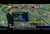
it's going to crest tonight at about 8:00. flood stage is 13 feet. it will crest at 21.6 feet. and that also is a forecast. so moderate flooding i think is possible on the monocacy. now we'll move to the potomac. upstream a little bit. point of rocks, flood stage at 16 feet. crest here is 22.3. 8 tomorrow that will be moderate flooding we think. and we'll move a little further south down to wisconsin avenue and near georgetown. flood stage 6 feet and crest 8.6. and this will not crest until 2:00 a.m. on thursday. we think that will cause minor flooding. we'll keep you posted and some of the numbers will fluctuate. the flood stage number will not but the chest number may -- crest number may fluctuate a little bit. winds still 22-mile-per-hour winds up in albany. this is sort of interesting a 32-mile-per-hour wind out in detroit and a 25-mile-per-hour wind as far south as raleigh, durham. the storm is not as strong but still plenty plenty big. notice the winds out of the
5:19 pm
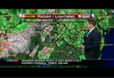
south now and a 16-mile-per- hour southwest wind out of orange and still gusting to 20 out in oakland. that's the case. live look outside, this is the michael & son weather camera. there are the clouds, 43. wow, do you want 39. -- dew point 39 so temperatures are not going to fall too much tonight. winds south-southwest at 10 and the pressure beginning to recover, beginning to recover to 9.89 inches of mercury. radar, all right we have a few showers across parts of the metro area. a damp commute home if anybody actually went to work today. we have snow though out west of the wide, as much as a foot of snow has fallen out west of the divide down the timber line in the valley. this is really more insult to injury. nothing in terms of heavy activity we're expecting over the next 12 to 18 hours. temperatures, they're chilly. i mean 42 in college park. 41 at bethesda and 42 great falls. they're also pretty uniform really. 42 ashburn and in centreville.
5:20 pm
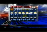
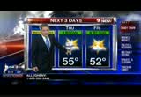
and 42 in college park as well. so the next three days we're going to keep tomorrow a 9 weather alert yellow just because of the river flooding. breezy may be a shower 54. 55 on thursday maybe a shower. friday, better. a little bit cool but 52. notice each day we get a little more sunshine. for the kids trick-or-treating it will be chilly and temperatures primarily in the 40s when they go out. next seven days ooh we get the extra hour this weekend. i know what i'm going to do with the extra hour this weekend. sunshine on saturday. 56. up to 68 on sunday. so upper 60s sunday and milder and the rain and showers on monday and then upper 50s on tuesday. so -- kind of a chilly halloween. but -- >> there's sleep in our future. >> there's definitely sleep in our future. yes. >> and you snowy may not -- we may not recognize the sun when we see it again. >> we might not. >> it might be too long. >> we might spy it tomorrow. area authorities keeping a close eye on the potomac.
5:21 pm
as all that rain from sandy is coming down river to us. we've got a live report. >> but up next, sandy did knock out power to tens of thousands of people across the area. the latest check on the numbers and restoration tilings right after the break. >> we want to let you know 9news now the teaming up with -- is teaming one the red cross, just "like" us on facebook and we will donate $1 to the sandy relief fund. go ahead and like our page. we'll be right back.
5:24 pm
compared to this summer's derecho and other past storms, our utility fared pretty well during sandy. still thousands of customers are without power because of sandy. we have been monitoring the numbers of outages for us, russ? >> hey i just posted new numbers on twitter, take a look at this. the current number of people without power, 270,000. that is about half of what we were reporting to you without power early this morning. so those are good numbers for the washington area. bge at 138,000.
5:25 pm
dominion at 61,000. potomac edisonat 48,000 and pepco, pepco at just over 6,000 customers now without power. so let's -- just pin -- move right in on some of those and this is the bge map right now. and you'll see there is a lot less color and that means a lot fewer people without power. still, though, our friends out in the annapolis area and anne arundel county, 39,000 customers without power and anne arundel county. the big trouble spot for bge right now is baltimore. take a look at northern virginia. still too much color around the arlington alexandria, fairfax city of fairfax area but you know you will look and you will see these numbers right now indicate that -- in northern virginia, dominion is doing a lot better. a total on their complete network of 67,000 customers without power right now. and in northern virginia, down to 65,000. and we're pretty much seen across all of these electrical
5:26 pm
providers half, half, half half of what they were at the worst points during the storm. and let's take a look at pepco. this is the pepco service map and we actually can see is a spot there. a spot where there are no outages so we have one pocket in washington without power. in all these pockets that pepco serves the numbers are pretty good. the number of right now just went up a little bit -- number right now just went up a little bit. 6,742. and let's take a look at our folks out in frederick county we're hearing a lot from them because they have had a lot of outages there. and the connections have been a lot slower than the others that we've been watching. right now, in frederick county, 21,000 customers remain without power. and system-wide for potomac edison. 48,000. that number is going down but not as dramatically as the other carriers and i'm hearing from those folks in frederick
5:27 pm
county they want their power back as do the rest of you. but i can tell you the numbers keep going down. >> when you don't have power, can't come back fast enough. thanks a lot russ. by the way power outages we know are more than just the numbers. coming up we go along with the pepco crew as they work to turn the lights back on for their customers left in the dark by sandy. >> and also ahead, we'll show you the toll that sandy's surge is taking on delaware beach communities. we'll be back in a minute.
5:30 pm
the worst of sandy may be gone, but it will be a long time before she's forgotten. here's the latest. the federal government most local governments and public schools all say they'll open regular time tomorrow. as o2:00 p.m., metro is ba out there on the roads and the rails on the sunday schedule. normal service gets back in tomorrow morning. and the early voting in maryland and d.c. will also resume tomorrow with some additional hours being scheduled to make up for the time we lost to sandy. most people who live along the delaware coast followed evacuation orders. >> and while the beaches did storm damage the biggest problems there are all the downed trees, the flooded roads and of course the power outages. >> our kristin fisher shows us what it was like when high tide hit this morning in lowes, delaware. >> reporter: this is high tide at the beach. we're about ten miles northwest from rehoboth beach and we tame here because this is the
5:31 pm
community we've been worried about through hurricane sandy. i'm very happy to tell you that this high tide is as bad as it's going to get for folks here. now you can see the water is rolling in and it's getting close. check out this home right over here and you can see that the waters are getting right up to the garage doors. so it came very close but so far, no flooding to report inside any of these homes. now as close as it's come during this high tide it was even worse during last night's high tide at the peak of hurricane sandy. i spoke with the owner of the daily market just up the road and he said that's the most scared he's ever been in a hurricane. >> i think this storm was the scariest storm at its peak. i've had blizzards and we've had nor'easters and a lot of flooding but this was by far the most flooding we've ever had. >> why was it so scary? >> just didn't know if it was going to end. the winds were just rong. the flooding was intense.
5:32 pm
it was the water this time that was the scariest. >> how close did all this water come up to your store? >> i think -- yesterday afternoon, it came up right to about the middle of the cars here. almost up to the bumpers. this whole thing was filled with water. >> reporter: so at high tide, here on millton street, you can see that we've got a few feet of standing water on the roadway. basketball net, toppled over in the wind and water. but for the most part, no flooding to speak of whatsoever inside any of these homes on millton street or any other homes on lewes beach. we have been all over this section of lewes beach and no homes that have taken on any significant water. just lots of pooling in the yards and on the streets. it's still really, really cold. we're still feeling some gusts of wind but the worst is over and now the clean-up begins. in lewes beach, i'm kristin fisher, 9news now. >> that's some welcome news, kristin, thanks for sharing it.
5:33 pm
the storm knocked out power to residents and to sewage treatment plant that's never good. howard county officials tell us the plant lost pour last night but it is restored today though not before some untreated sewage made its way into a local river. preeti arla has the details for us. >> reporter: officials tell us that the storm knocked out both power sources to that facility and that's a very unusual situation they say. one is undergrounds and one is aboveground. normally that wouldn't happen. in this case it did and it created quite a problem. impact adds you were saying raw sewage going into the little patuxent river. officials were offline for about 12 hours they say and it was caused by the storm monday night. and they say for each hour that the power was off, about two million gallons of sewage leaked out. and they say that was a major issue they say about 24 million gallons of raw sewage could have gone into the river during that period of time.
5:34 pm
but to give you a little bit of perspective. they say each day on that river about 500 to 600 million gallons of water is flowing and they say on a day like yesterday with a lot of stormwater, the amount of water in that river was probably twice as much as that. so if you look at it in that light they say it is a very situation -- very serious situation something hay don't want to see happen again but they say there's very little health risk in this situation. one other issue though, was that it took 12 hours again for them to get that power back on. now baltimore gas and electric runs the power out there and they say that because of the conditions out there, they say that they took longer to get out there but that it was their main priority. but again the situation has been taken care of and they are back online at least one of those sources is back online. and they're waiting to get the other one back on but of course no health issues again. in laurel, preeti arla. 9news now.
5:35 pm
>> no more untreated sewage going back out into the water. thanks. even though we did not get the flooding that we'd expected the threat is still out there. >> emergency officials still have their eye on the potomac. peggy fox joins us live from king and union streets in alexandria. >> reporter: that's right. she's back! just when we thought hurricane sandy was gone, here come her remnants, that is right and high tide is not even until 9:00 tonight. this has been a pretty rapid rise. in fact, i parked the company vehicle right here because police said remove the barricades. they thought it was oak until later this owning and i came out -- okay until later this evening and i call out and found it -- came out and found it getting close. the drier of the ford right there was not so lucky. a lot of hurricane sandy are dealing with flood waters coming into the basements. and more people however are probably dealing with damage from downed trees. >> it made quite a noise. >> reporter: that oak tree
5:36 pm
crashed into art's house around 10:30 last night. he hired a tree company for $8,000 to get it off today. >> that's a lucky one. yeah. that's just a corner. we've had them go through the bedrooms and everything. >> reporter: like this one, another oak smashed right through the 1938 home of real estate agent donny wintermute. >> huge crash in my house. and the tree which is over 100 years old and 100 feet high went up and over the house and it literally split the house in half. >> reporter: she's making plans to share the coast of a crane with a -- cost of a crane with a neighbor who also has a tree on the house. only his didn't crash through like hers or this other alexandria hoe. the owner is hoping to rebuild. here's what's left of a roof that blew off a garden apartment complex here in alexandria at the height of the storm. >> we just started hearing like -- crashing noises. >> reporter: around 10:30 last night that roof came right off the building at the seminary
5:37 pm
hills garden apartments. her toddler knew exactly what it was. >> my baby's -- what is that? dragons are coming. >> reporter: a dragon named sandy. >> i'm scared. >> it was very scary. >> reporter: even though the worst is over alexandria handed out sandbags this afternoon. in fairfax county's huntington community, there was a feeling of relief that cameron run stayed in her banks. so far. >> i feel like weaver lucky you know. everybody dodged a lot of wet basements and ruined houses and hopefully everyone is safe and that's good. >> reporter: yes, that's good. but we're still kind of holing our breath -- holding our breath at least here in oldtown. the water has quickly pushed up to the base there of union and king. and we're kind of -- just rising right before our eyes and we really have to watch that n because again, as i said earlier, high tide is at 9:00 tonight. so we have -- we have some time
5:38 pm
here i'm sure the emergency officials will also be watching for closely in huntington area of fairfax county and bell view. those two areas very prone to flooding. those people really need to be on the watch tonight. i'm peggy fox reporting live in oldtown, back to you. >> and topper emergency officials were saying last night they were waiting to see what happened as the potomac crests. >> the problem is we also have a full moon tonight along with that high tide around 9:00. we'll talk about that and we'll always remind everyone that we were in the 80s last week and don't forget you can always get the latest on the aftermath of superstorm sandy anytime at wusa9.com. stay with us, we'll be right back.
5:41 pm
we really want to hear what you and your family have been going through experiencing in the aftermath of the storm. >> so be sure to go to our facebook page to report any power outages or damage. and send us your pictures. >> and you can track the remnants of sandy by following us and the 9 weather team on twitter. the handles are -- and when we come back kristen berset shows us some of the
5:44 pm
5:45 pm
passed and it's still possible for more damage to happen with flooding et cetera upload any pictures from our area to our wusa9 facebook page. i'm here with kristen berset. kristin all last night you were bringing in these pictures and showing us amazing images submitted by our viewers. >> yes and still been coming in today and we thank you all for submitting the pictures. i want to start with some video first. >> okay. >> it's actually from the shore of new jersey. just to show you just how widespread this damage really has been. it's from the national guard. the video you just see the flooding. the devastation with these homes. i mean it's just absolutely incredible this video. and it's -- it's been circulating and we wanted to really show that to you. now if we can take to you some of the pictures that we have. one of the redskins' players actually tweeted us this picture. this is from long snapper nick sunday berg. this is redskins park just completely flooded. thankfully they have today off and also thankfully they have the new practice bubble and actually be able to prepare for
5:46 pm
the weekend's game against carolina. our own kristin fisher sent this picture of flooding from delaware. you can just see the neighborhood street just absolutely flooded. so it's devastation there. also sarah shookman here helping us from wkyc in cleveland sent us this picture of a water rescue at the monocacy river. you know just be careful when you're driving on those flooded roads. and also this incredible picture now we've seen a lot of fake pictures anita. a lot of incredible things. >> you were telling us about that. >> this is from a professional photographer. she promises this is real. look at this rainbow. it happened after a short drizzle this morning and just an incredible sight. among everything else that they're having to deal with. i do want to share one more. and it's -- happy pictures on a happy note. if you can take the computer screen, this again from kristin fisher in rehoboth beach and just the sun coming out as we've heard her day earlier today. you know they kind of got spared out in rehoboth.
5:47 pm
just a beautiful sight. >> that rainbow shot over new york city where so many people dealt with horrible flooding, power out. tunnels still flooded out you need a rainbow at a time like that. >> several days of clean-up for new york city and new jersey. >> at least. okay. kristen berset thank you. >> thank you. and we would like you to "like" us on facebook and if you do, we're going to donate $1 to the american red cross sandy relief fund. please consider going to wusa9 on facebook and liking our page. back to you guys in the studio. >> that's something we can support. but you -- you're sort of skeptical of that picture with the rainbow? what's up? >> i mean it may be real. it looked too perfect for me but to me you never know. >> you never know. let us choose. >> we are going to accept that. exactly. winds pretty much gone. i mean a little breezy the next couple of days but we are looking at some old care, for -- cold air, the southwest wind it's like march outside. temperatures in the 30s and 40s. let's start though with the picture -- i like sandy's other side as it were. sandy's snow and check this
5:48 pm
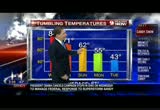
out. look at this guys, this is snow shoe, they'll probably have another 6 to maybe 10. this was sent to us by snow shoe by kristin. we appreciate that. we'll show you a different one coming up at the 6:00 hour which is quite nice too. now, let's talk about this. how quickly we forget how nice it was just last week. we got tumbling temperatures. i mean in a big way. last wednesday, it was 84 degrees for crying out loud and it went downhill after ha so to speak. 71 on friday and 62 on sunday. and then monday, 55. and today we hit around 43. so that is a huge change in temperatures over a really relatively short span. all right, satellite picture radar combined we still see this circulation of sandy and she hasn't disappeared just yet. still looking at rain showers in the ohio valley and in our area and some snow in the appalachians and yes the snow went all the way down to the smokies of tennessee and north carolina. and that will continue for a while. our showers, won't be very
5:49 pm
heavy. they'll be kind of scattered tonight and as we go through tomorrow we'll have a much better chance of seeing a couple of breaks in the clouds and just a few showers around. michael & son weather camera live looking out northwest we still have plenty of low clouds but nothing heavy which is good. we've had plenty of rain. 43 right now. the dew point still 39. so humidity kind of high. pressure's steadily over the past hour. -- steady over the past hour. and rather low. 29.38 inches of mercury but it's recovering in general and the winds south-southwest at 10. that's normally a warmer wind. the radar, 66 but notice it's green and green is light activity. we like that. and yes, a little bit of a mixture a wet snow flake tonight around hagerstown and in frederick tonight and perhaps as close as clarksburg but that's about it. for the most part just a raw night. temps 41 right now in rockville. 41 in bethesda. 42 in great falls. 41 also in fairfax.
5:50 pm
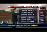
temps pretty uniform actually. 42 college park and we're looking at 41 up in laurel. so breezy and cool just a few showers tonight. grab a jack fete you're going out. you can see -- jacket if you're going out. you can take the jacket and leave the umbrella. not a huge deal. i think mainly a dry morning commute and the kids will need a jacket in the morning no doubt about that. in the 30s ands. so for tonight mostly cloudy and breezy and cold, showers mountain snows continue. 36 to 42 winds southwest at 10 to 15. by morning mostly cloudy, breezy and cold. maybe a shower. 30s and 40s. winds southwest at 10 to 15. and then by afternoon, we'll say variable cloudiness and might see a little peek of the sun tomorrow. breezy and cool and showers still possible and highs around 55. winds west southwest at about 10 to 15. so again, still a little by breezy tomorrow. -- bit breezy tomorrow. all right zone forecast. we have more snow in oakland, maybe 33. jump the divide. 42 in cumberland and 49 in hagerstown. maybe 50 in particular tinsburg
5:51 pm
and 52 or so in richmond. mid 50s culpeper and leesburg and manassas and fairfax probably 54 or 55. downtown 55. mid 50s as you head up to 70 and mid 50s also as you head into southern maryland. small craft advisory for parts of the bay and tidal potomac tomorrow. so next three days we're going to -- be talked out of this right now we'll say a yellow tomorrow for our 9 weather alerts. breezy with a shower. mainly for the river flooding. and then a bit cool on thursday and maybe a shower. 55. and a bit cool on friday but more sunshine 52. next seven days, weekend okay. 56 on saturday. extra hour of sleep saturday night. and then 68 on sunday. back in the upper 50s monday and tuesday of next week. with some rain and showers on monday, trick-or-treating tomorrow night will be chilly. temps primarily in the 40s so keep that in mind if your kids are in fact going out. >> i'm going to have to wear a jacket over the costume. >> one of the day you can actually complain derrick
5:52 pm
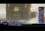
because we lost 40-degrees from last week. >> that's legitimate. >> i'm too tired to complain now. as the east coast recovers from superstorm sandy. north carolina is doing it a little differently. parking lots of their region was blasted with snow. so you know. >> you don't think of that in north carolina with a hurricane. >> you don't. so imagine them braving the harsh winds to shovel around their homes and cars and some of the areas were hit so hard, that plow trucks had to be dispatched to clear the roads. >> they don't -- how often do they have snow in north carolina in october? it can't happen much. >> i know and then blizzard conditions remain if parts of west virginia where more than a foot of snow in low lying areas and then more than 2 feet in the mountains. >> at one point more than 45 miles of i-68 on either side of the west virginia and maryland state line was closed because of hazardous driving conditions and stuck cars. >> anna warner has the story. >> reporter: overnight, plows tried to keep up with the wet
5:53 pm
heavy snow and high winds that blew it across the roads. but it was already too late for medical deliveryman gary atkins, his car flipped on a road slippery with snow. >> there was a truck stopped and kind of got sideways in front of me. and when i went to slow down, my truck went sideways and there was no stopping. >> that was it. >> that was it. it was over in a second. >> reporter: one traffic accident fatality in the state was blamed on the storm as blizzard conditions swept in monday evening. it only got worse overnight, with predictions of 6 or more inches in towns like elkin and 1 to 3 feet at the highest elevations. power outages followed the snow as trees and power lines snapped. >> with the heavy snowfall you can anticipate some downed trees and when that happens you just can't go out effectively remove snow. you have to deal with trees. >> reporter: the storm is coating parts of seven states in an early winter blanket from
5:54 pm
north carolina up through western pennsylvania. west virginia governor earl ray thom when urged people to be prepared for days without electricity or flies. >> i've always encouraged people to get what supplies they need. food, water, battery and candles and enough to do them for a couple of days, i don't want anyone to panic but at the same time you should be prepared for the storm as it moves through the state. well, still ahead tonight, you don't physically think of hurricanes alongside the great lakes. but we're going to take a look at the impact of what's left of sandy is having on the midwest.
5:57 pm
5:58 pm
michigan. so big that they shut down the rides at the navy pier as a precaution, in fact a flood warning still in effect there through tomorrow afternoon. also tomorrow president obama travels to new jersey to join governor chris christie and sea some of the damage there. now the president is marshaling the forces of the federal government to help everyone hit by sandy and he's telling federal agencies and get the help where it's needed quickly. this afternoon mr. obama visited national headquarters of the red cross here in d.c. and there he thanked the relief agencies for doing their thing and warned sandy is not done with us yet. and similar sentiments from republican presidential nominee mitt romney. he was in debtorring, ohio today helping volunteers collect food and other supplies for families hit by the hurricane. romney said americans always come together in times of crisis. and one week from today one of the two men will be elected the president for the next four
5:59 pm
years and of course a lot of americans have decided to take advantage of early voting. and today, maryland governor martin o'malley announced it will resume across the state tomorrow. you know it was canceled yesterday and today because of the weather being so bad and to help make up for the lost time the hours are being extended from 8:00 a.m. to 9:00 p.m. and they're adding a whole extra day for early voting that would be this friday. she may not be a hurricane anymore, but we are still tracking the impacts of what was sandy tonight. thank you for joining us. >> we want to start you off with some of the headlines out of the storm at this hour. >> first off, we can tell you the federal government will be open for business as usual tomorrow. however, employees will have the option of using unscheduled leave of working from home -- or working from home. >> now from schools, we've heard from alexandria and mo
136 Views
IN COLLECTIONS
WUSA (CBS) Television Archive
  Television Archive News Search Service
Uploaded by TV Archive on

 Live Music Archive
 Librivox Free Audio
 Metropolitan Museum
 Cleveland Museum of Art
 Internet Arcade
 Console Living Room
 Books to Borrow
 Open Library
 TV News
 Understanding 9/11